

As the largest, hottest, and lowest National Park in the contiguous United States (that means everywhere but Alaska and Hawaii), planning a trip to Death Valley is truly a once-in-a-lifetime experience and a must for any nature lover.
The dramatic landscape and harsh environment make it one of my favorite places in the entire country – if not the whole world – and I’m sure you’ll feel the same after visiting. This guide with help you make out how to make the most of 2 to 3 days in the national park so you can cover as much ground as possible in this incredible natural wonder!

Table of Contents
How Many Days in Death Valley?
Death Valley is a sprawling desert location with endless acres of land to explore (3,422,024 acres to be exact). As the largest National Park outside of Alaska, you might think it would require weeks to explore the park.
However, much of the park is inaccessible and even dangerous (think getting stranded in the desert danger, as opposed to the wildlife danger other US parks might evoke).
So when trying to decide how many days to spend, it’s more about the driving distance between all the key sites and best hikes than it is about trying to view every inch of the multi-million acres of desert.
If you’re looking to see the main sites, go on a few hikes, and explore some hidden gems, 2 days are perfect. If you want time to explore the backroads or scale Telescope Peak, you’ll want 3 days.
However, if you simply want to see this incredible area and don’t have a lot of time to devote to it, you can spend one day in Death Valley or even do a day trip from Las Vegas, located only about 2 hours away.

Getting To & Around Death Valley National Park
The first thing to keep in mind when planning your trip is when you’re visiting. In the summer, Death Valley is one of the hottest places on Earth.
For this reason, I highly recommend visiting between November and March as the weather is much milder and the hiking trails much more doable. Because of how extreme this park is, it may even be worth visiting Joshua Tree vs Death Valley if that makes sense to you.
If you’re visiting during this season, the following itinerary is the perfect way to fill your time. If you’re visiting in the summer, well, I don’t have much advice to offer other than good luck.
Death Valley is filled with dirt roads and difficult terrain, so the right vehicle is crucial. There is no public transport into or around the park (unlike in other national parks like the Grand Canyon or Yosemite) and people have died on the more remote roads after breaking down in the summer without extra water.
So make sure to have the right car and plenty of water, even if you’re visiting in the winter (which you should definitely do; avoid summer in Death Valley at all costs).
While a regular car will allow you to access most of the spots on this itinerary, some of the more unique destinations, especially the backroads, require four-wheel drive and high-clearance vehicles. All-terrain wheels are highly recommended.
Located on the border of California and Nevada, you can easily get to Death Valley from a number of different nearby towns and cities. For instance, it’s about 2 hours from Las Vegas to Death Valley, making it a popular spot to visit from Sin City.
If you’re not driving you can organise a full-day tour from Vegas or even a stargazing tour which will give you plenty of time in the park.
If you need to rent a car for this trip you can browse DiscoverCars.com to compare prices across several companies.
Alternatively, you can browse Outdoorsy if you want to rent an RV or campervan, particularly if Death Valley is one stop on a longer road trip such as from LA to Yosemite.

2 to 3-Day Death Valley Itinerary
Whether you choose to spend 2 days in this incredible desert area or 3, this itinerary will help you make sure you see all the best sites. From gorgeous drives to spectacular hikes, plus a few of the park’s stranger destinations, this route will help you make the most of your visit.
Day 1 – Badwater Basin, Natural Bridge, Devil’s Golf Course & More
Badwater Basin
Start your trip with the most iconic things to do in Death Valley: visiting Badwater Basin. As the lowest point in North America, Badwater Basin sits at 282 feet below sea level and consists of 200 square miles of salt flats.
The salt was left behind when Lake Manly evaporated tens of thousands of years ago and is now home to a sprawling snow-white landscape that will make you feel as though you’ve been transported to another planet.
You can view the salt flats from the boardwalk just off of the Badwater Basin parking lot, or take the easy 1.5-mile walk through the basin for a better view.
Natural Bridge
A three-minute drive from the Badwater Basin will bring you to the Natural Bridge trailhead. From here, it’s a .5-mile hike to the Natural Bridge, a natural archway made out of rock, gravel, and sediment.
The bridge was carved by flash flooding over thousands of years and is now a stunning sight for visitors to walk under and explore during their time in Death Valley.
Note that, like many sites in Death Valley, the trailhead for the Natural Bridge is located off a dirt road, so make sure to plan accordingly and check road conditions with the local ranger.

Devil’s Golf Course
Keep driving from the Natural Bridge trailhead about 10 minutes north to reach the Devil’s Golf Course. The sand crystal formations at Devil’s Golf Course are another must.
The rocky peaks and craters look like they would be more at home on the moon than in California and have formed from years of wind and rain eroding the salt into jagged spires.
It may sound odd, but make sure to keep your ears on high alert while you’re there! If you listen closely, you can hear the tiny pops of billions of salt crystals bursting as they expand and contract in the intense heat of Death Valley.

Artist’s Drive & Artist’s Palette
Next up is Artist’s Drive, a 9-mile paved road that weaves through the rainbow hills of Death Valley. Over the years, volcanic deposits piled atop each other to create this multicolored, striped landscape.
Make sure to stop at Artist’s Palette, a viewpoint showcasing everything from deep reds and oranges to spots of turquoise and violet. The colors are at their most vibrant in the afternoon, so save this stop for later in the day to get the boldest impact.
Golden Canyon to Red Cathedral
After completing Artist’s Drive, it’s time to stretch your legs again. Head to Golden Canyon Trail for the first real hike of your trip to Death Valley. The trailhead is just off of the main Badwater Road and from here, a 3-mile out-and-back trail will take you through Golden Canyon to the Red Cathedral.
It takes about an hour and a half to get there and back and is well worth it.
You’ll hike through the golden walls of this rocky corridor until you reach what’s known as the Red Cathedral: a wall of terracotta pillars that look like they’ve been carved by a pious worshiper, but are really the result of years of erosion.

Sunset at Dante’s View
To round out your first day, head to Dante’s View for a gorgeous sunset. From here, you can look down on the breathtaking views of the swirling white salt flats below. Famous in its own right, Dante’s View was also the location where the first shot of Mos Eisley was filmed for Star Wars.
While it’s an incredible view any time of the day, it’s especially popular for sunset because you can watch the sky change from blue to gold to pink over the sprawling Death Valley landscape.
Day 2 – Zabriskie Point, Mosaic Canyon, Ubehebe Crater & More
Sunrise at Zabriskie Point
If you’re only taking 2 days to explore Death Valley, I highly recommend starting your second day by viewing the sunrise. It can be a push to get up early enough for sunrise, which can be as early as 5:30am depending on the time of year but trust me when I say it’s worth it.
From Zabriskie Point, you can watch the dunes transform from their usual sandy beige to stripes of cobalt and rose. If you’re lucky, moonset will coincide with sunrise for a truly magical view.

Twenty Mule Team Canyon
Just east of Zabriskie Point, you’ll reach the entrance to the Twenty Mule Team Canyon drive. This 2.5-mile drive takes you along a one-way road through what is both a stunning natural landscape and a historical site.
From 1883-1889 the Twenty Mule Teams carried tons of borax on 16-foot oak wagons that weighed upwards of 73,000 pounds. Today, you can drive through the area for a chance to see some stunning views.
Star Wars fan? You may recognize the landscape as the place where Jabba the Hutt’s palace was located.
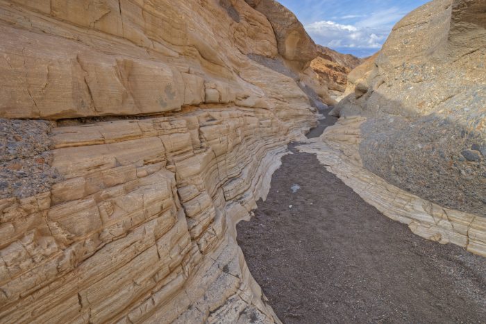
Mosaic Canyon
Looking for an up-close-and-personal view of the canyons? About an hour drive from the Twenty Mule Team Canyon drive and a stone’s throw from the Mesquite Flat Sand Dunes & Stovepipe Wells is the trailhead for Mosaic Canyon. From there, you can head out on a 4-mile out-and-back trail through the smooth marble walls of this narrow canyon.
During the hike, keep an eye out for the natural mosaic rock formations made of a variety of different rock types held together by natural cement.
Ubehebe Crater
Next up is Ubehebe Crater. This 600-foot volcanic crater is half a mile across and was created by steam and gas explosions about 2,000 years ago.
The crater can be viewed from a parking lot located on the rim, but if you’re interested in seeing smaller additional craters and the unique impact of years of erosion, a 1.5-mile round-trip trail takes you around the rim.

Scotty’s Castle
It may take a bit of a drive to reach, but if you’re willing to make the drive, Scotty’s Castle is a great addition for anyone spending 2 days in Death Valley.
Tucked inside the park is a desert oasis known as Grapevine Canyon, this 1920s mansion is a great way to see what life was like in Death Valley before it became a national park. Due to recent flooding and fires, tours are only available via reservation.
In addition to seeing Scotty’s Castle, you’ll get a chance to learn about the flood recovery efforts that are currently underway.
Stargazing at the Mesquite Flat Sand Dunes
The sand dunes of Mesquite Flat are stunning any time of day, but for a truly spectacular experience, head there after sunset for a chance to see an endless night sky—and possibly even the Milky Way!
As a certified International Dark-Sky Park, you can see thousands of stars in Death Valley, including many constellations that are hard to view elsewhere in the country.

Day 3 – Backroads, Telescope Peak & Rhyolite
After a very full 2 days, you may be ready to head home, but for those spending 3 days on their trip to Death Valley, there’s still plenty to see and do.
For those with a car that can handle rough roads, exploring the backroads is a great option. For those who are craving an all-day hike with stellar views, it’s time to head to Telescope Peak.
Explore the Backroads
The backroads in Death Valley are one of the park’s most unique and interesting features. The Eureka Dunes are the tallest sand dunes in the state and look more like the deserts of the Savannah than southern California.
It’s 44 miles of graded dirt to reach the dunes from Ubehebe Crater Road, but you’ll be rewarded with towering golden dunes.
Another favorite of Death Valley backroads is Racetrack Playa. Named for the tracks left by the mysterious moving rocks, it’s a rough and remote drive that takes about 3.5 hours from Furnace Creek. On your way, make sure to stop at Teakettle Junction for a great photo op.
Next on the list for backroad adventurers is Aguereberry Point Road. This 6.4-mile road is one of the more challenging backroads in the park, but the reward is stunning vistas of the park and a chance to see the more mountainous regions of Death Valley.
For those spending 3 days here, exploring the backroads is a great option. But if you don’t have the car for it or would rather get your feet moving, hiking Telescope Peak might be for you.

Hike Telescope Peak
Telescope Peak is a 13-mile out-and-back hike that takes 7-8 hours to complete. It’s one of the most challenging hikes in Death Valley as you’ll climb upwards of 3,000 feet.
The reward is the pride of scaling the 11,000-foot peak (the highest point in Death Valley) and the chance to see some truly once-in-a-lifetime views of the park.
On a clear day, you can see both the lowest and highest points in the contiguous United States: Badwater Basin (282 feet below sea level) and Mount Whitney (14,505 feet above sea level).
Visit Rhyolite
Whether you’re exploring the backroads or hiking Telescope Peak, a great way to end the last day of your trip is to visit the ghost town of Rhyolite.
Located just east of the park, Rhyolite was a bustling town for prospectors in the early 1900s. Today, it sits in ruins.
When visiting Rhyolite, you can see both the remnants of the town that once thrived in the area as well as modern art and the Tom Kelly Bottle House that have been added to the town in the years since.

Where to Stay in Death Valley
The Inn at Death Valley – This plush inn has a number of lovely rooms available. There are also plenty of amenities including a pool, fitness centre and sauna and an on-site bar.
Death Valley Inn & RV Park – This inn and RV park is a great option. There are a number of nice rooms available that are suitable for everyone from solo visitors to families. There is also an outdoor pool and BBQ facilities.
Private Rental – If you’d like to have a taste of home while visiting Death Valley National Park, then a private vacation rental such as this comfortable house in Pahrump is a good choice for you.
Not quite what you’re looking for? Click here to browse more Death Valley hotels!
No matter how long you plan to spend in Death Valley, there’s no doubt it will blow your mind. With plenty of spectacular natural sites to see and stunning canyon hikes to fill the hours, it’s one of the country’s most unique National Parks.
Are you planning to visit Death Valley? Have any questions? Let us know in the comments!


Enjoyed your information and suggestions. Any way to get a map of the itinerary you outlined above showing all locations along the way? Also, where can one stay in a motorhome that has hookups (at least electricity) for a night or two and where along the route that you described can this/these locations be found? We’ve never been to DV before and appreciate any input. Thank you.